Discover the most Recommended Resources for SPSS Assignments to boost your statistical analysis skills. From expert guides to reliable datasets, this comprehensive list will help students and professionals master SPSS with confidence and accuracy. Perfect for academic projects and real-world data challenges.
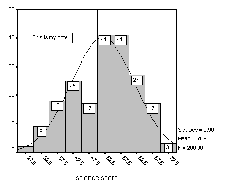
.png)
Introduction
SPSS (Statistical Package for the Social Sciences) is a powerful statistical software widely used in academic research, business analytics, and social sciences. However, mastering SPSS requires practice and access to high-quality learning resources. Whether you’re a beginner or an advanced user, having the right tools can make the difference between struggling through assignments and excelling with confidence.
This guide provides a detailed list of recommended resources for SPSS assignments, including:
✔ Free and Paid SPSS Tutorials (YouTube, Websites)
✔ Official IBM SPSS Support and Documentation
✔ Academic Textbooks and Step-by-Step Guides
✔ Online Forums and Communities for Troubleshooting
✔ Practice Datasets and Exercises
By the end of this article, you’ll know where to find the best materials to learn SPSS efficiently, troubleshoot errors, and complete assignments successfully.
Free SPSS Tutorials (YouTube & Online Courses)
YouTube Tutorials (Best for Visual Learners)
YouTube is a goldmine for free SPSS tutorials, ranging from beginner basics to advanced techniques.
Top SPSS YouTube Channels:
| Channel |
Focus Area |
Why It’s Useful |
| Research By Design |
Beginner to Intermediate |
Clear, step-by-step guides on running tests (t-tests, ANOVA, regression). |
| Tutorials Point |
Basics & Data Entry |
Great for absolute beginners learning SPSS interface. |
| Dr. Todd Grande |
Advanced Statistics |
Covers complex analyses like MANOVA and factor analysis. |
| Andy Field (Official) |
SPSS with Humor |
Author of Discovering Statistics explains concepts engagingly. |
Recommended Playlists:
-
“SPSS for Beginners” (Research By Design)
-
“Learn SPSS in 15 Minutes” (Tutorials Point)
-
“Advanced SPSS Techniques” (Dr. Todd Grande)
Best For: Students who prefer visual, hands-on learning with real-time demonstrations.
Free Online Courses (Structured Learning)
Several platforms offer free introductory SPSS courses with certificates (optional paid upgrades).
| Platform |
Course Name |
Key Features |
| Coursera |
IBM SPSS Statistics Level 1 |
Official IBM course, beginner-friendly. |
| Udemy (Free Section) |
SPSS Basics |
Short, practical lessons. |
| edX |
Data Analysis for Social Scientists |
Covers SPSS in research contexts. |
Best For: Students who want structured, university-style lessons with quizzes.
Official IBM SPSS Support & Documentation
IBM SPSS Statistics Guide (Official Manuals)
IBM provides comprehensive official documentation, including:
✔ User Manuals (PDF guides for each SPSS version)
✔ Tutorials on Data Management & Analysis
✔ Troubleshooting Common Errors
Where to Find It:
Best For: Users who need official, technical reference material.
IBM SPSS Support Forums
Best For: Solving software-specific errors (e.g., licensing, crashes).
Academic Textbooks & Step-by-Step Guides
Best SPSS Textbooks for Students
These books are widely used in universities and provide both theory and practical SPSS steps.
| Book Title |
Author |
Why It’s Useful |
| Discovering Statistics Using IBM SPSS Statistics |
Andy Field |
Humorous, beginner-friendly, covers tests in-depth. |
| SPSS Survival Manual |
Julie Pallant |
Step-by-step guide for non-statisticians. |
| IBM SPSS for Introductory Statistics |
Morgan et al. |
Simplifies complex concepts for beginners. |
Best For: Students who want detailed explanations + SPSS screenshots.
University SPSS Handbooks
Many universities publish free SPSS guides (e.g., UCLA, University of London).
Best For: Quick, assignment-focused reference sheets.
Online Forums & Communities
Stack Overflow & Cross Validated
Best For: Technical troubleshooting (e.g., syntax errors).
Reddit & Facebook Groups
Best For: Peer support and quick answers from experienced users.
Practice Datasets & Exercises
Free SPSS Datasets
Practicing with real datasets helps reinforce learning.
| Source |
Dataset Type |
Link |
| Kaggle |
Public datasets (CSV format) |
kaggle.com |
| UCI Machine Learning Repo |
Academic datasets |
archive.ics.uci.edu |
| IBM Sample Data |
Built-in SPSS practice files |
(Included with SPSS installation) |
Best For: Hands-on practice before working on assignments.
Step-by-Step Exercises
Best For: Reinforcing concepts through repetition.
Paid Resources (For Advanced Users)
Premium Online Courses
| Platform |
Course |
Price |
| Udemy |
SPSS Masterclass |
~$20 (often on sale) |
| LinkedIn Learning |
SPSS Essential Training |
Free with trial |
Best For: In-depth, ad-free learning with certificates.
Private Tutoring
Best For: One-on-one help for tough assignments.

How to Choose the Right Resource?
| Need |
Recommended Resource |
| Absolute Beginner? |
YouTube (Tutorials Point) + SPSS Survival Manual |
| Stuck on an Assignment? |
Reddit (r/SPSS) or Stack Overflow |
| Preparing for Exams? |
Andy Field’s textbook + practice datasets |
| Advanced Statistical Modeling? |
IBM Documentation + Coursera |
Conclusion
Mastering SPSS requires a mix of free tutorials, textbooks, forums, and hands-on practice. Key takeaways:
-
Start with YouTube for visual learning.
-
Use official IBM guides for technical reference.
-
Join online communities (Reddit, Stack Overflow) for quick help.
-
Practice with real datasets to build confidence.
By leveraging these resources, you’ll save time, avoid mistakes, and submit high-quality SPSS assignments with ease.
Final Checklist Before Starting an Assignment
✔ Watched a YouTube tutorial on the required test?
✔ Checked IBM’s official documentation for syntax help?
✔ Joined r/SPSS or a Facebook group for peer support?
✔ Practiced with a sample dataset before working on the real assignment?
Now you’re ready to tackle any SPSS task like a pro! 🚀